One of the goals of MetEOC-3 is to provide  traceability for estimating terrestrial biophysical Essential Climate Variable (ECV) products through in situ, airborne and satellite measurements. Satellite-derived ECV products and the algorithms they use depend on empirical in situ measurements collected on the ground, which requires long term monitoring at field sites. However, ground data collection can be highly laborious and time consuming and thus more efficient methods to produce in situ measurements are required. Drones offer a convenient measurement platform between those done on foot and from manned aircrafts. They also have the potential to provide autonomous test site monitoring and reduce laborious ground measurements requiring humans. MetEOC-3 continues the work started in the previous MetEOC projects in developing traceable …

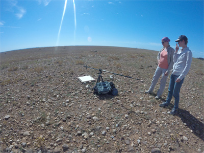
Drone-based laser scanning and hyperspectral imaging conducted at Wytham Woods test site Read more »

The European reference radiative transfer model was renamed as Eradiate. Information and news about the model are available at www.eradiate.eu. In this post, we summarise the requirements elicitation process and give a brief overview of ongoing activities. A part of the activities taking place in the framework of MetEOC-3 consists in laying foundations for the development of a next-generation radiative transfer model to support calibration/validation activities. Initially simply named ER2TM, as in European reference radiative transfer model, this software package is meant to provide a reliable, extendable and comprehensive framework for radiative transfer simulation.   A new name, a new website In June 2018, the ER2TM was renamed Eradiate. This uncommon word, which has the same meaning at ‘radiate’, brings a more distinctive …

A Radiative Transfer Model For The Earth Observation Community Read more »

On Friday 13 October 2017, the Sentinel-5P satellite bearing the Dutch TROPOMI space instrument was successfully launched from Plesetsk, in Siberia. From space, TROPOMI will monitor the air quality and distribution of greenhouse gases worldwide. This groundbreaking instrument will strengthen the position of the Netherlands as a supplier of high-end aerospace instruments.   TROPOMI, which stands for TROPOspheric Monitoring Instrument, is a satellite instrument that will carry out measurements on the troposphere, the lowest layer of our atmosphere. It is capable of measuring air quality to an unprecedented degree of accuracy, and of identifying carbon monoxide, methane, nitrogen oxide, and ozone, among other things. “The launch of TROPOMI means a new standard is being set in the field of atmospheric research,” …

Tropomi measuring air quality, carbon monoxide, methane, nitrogen oxide, and ozone with unprecedented accuracy Read more »

SPECCHIO is a spectral information system designed to hold reference spectra and spectral campaign data obtained by spectroradiometers. MetEOC-3 is going to use a dedicated SPECCHIO spectral information system instance to deal with the multifaceted spectral point data accumulated in various activities related to sensor CAL/VAL. MetEOC-3 is going to use a dedicated SPECCHIO spectral information system instance to deal with the multifaceted spectral point data accumulated in various activities related to sensor CAL/VAL. SPECCHIO is a specialised software solution to allow the organised storage of spectral data accompanied with detailed metadata to describe the sampling conditions, experimental setups and target properties. One key feature is the easy sharing of data within a research team and the selection of spectral data …

Streamlined Spectral Data Management using SPECCHIO Read more »

The MetEOC-2 partners have produced second MetEOC-2 newsletter the  detailing some of the activities undertaken in 2016 within the MetEOC-2 programme. Download the newsletter

Meteoc-2 site visit to observe an example of site characterisation field work Agnieszka Bialek and Claire Greenwell of NPL visited the CNES site at La Crau, France, part of RadCalNet, a prototype network of automated vicarious satellite reference sites. This visit was one of four planned visits to RadCalNet prototype sites during the MetEOC 2 project, including the Gobabeb Research and Training Centre, Namibia, where a new member site of RadCalNet is currently being established.

The National Physical Laboratory (NPL) published an extensive report Metrology for Climate – Metrology priorities for the earth observation and climate community, containing the recommendations from international research organisations on the role of metrology in supporting climate research. The report summarises the workshop ‘Metrology for Climate’  hosted by the National Physical Laboratory (NPL) on 21-22 May 2015, organised in conjunction with technical experts from European Space Agency (ESA), EUMETSAT, the European Commission, the UK Met Office and the University of Reading. The two-day workshop investigated the role that metrology should play in supporting the robust measurement of Essential Climate Variables. The concept of Essential Climate Variables (ECVs) provides a systematic and internationally consistent framework of variables/parameters to facilitate the monitoring and understanding of climate change and forecast models. …

Metrology for Climate workshop follows up 2010 BIPM/WMO recommendations challenges for the metrology community specific to ECVs Read more »

This part of MetEOC-1 utilised and refined the infrastructure created in the opening part of the project through 1) the characterisation of stray-light properties of an airborne hyper-spectral imager and set of ocean colour sensors using the spectrally tuneable laser, 2) construction and testing of a large aperture radiance source (lamp), 3) pre- and post-flight characterisation of the new black bodies used for in-flight calibration and, 4) the design of a new LED-based, self-calibrating radiometer, as well as testing of its constituent components. D’Odorico, P., Gonsamo, A., Damm, A. and Schaepman, M.E. of RSL have their paper ‘Experimental evaluation of Sentinel-2 spectral response functions for NDVI time-series continuity‘ published in IEEE Transactions on Geoscience and Remote Sensing

The Gimballed Limb Observer for Radiance Imaging of the Atmosphere (GLORIA) is a German airborne imaging FTS (Fourier Transform Spectrometer) capable of operating on various airborne platforms for sensing dynamics and chemistry of the UTLS (Upper Troposphere and Lower Stratosphere) region. The instrument is a joint development of the research centers KIT (Karlsruher Institut für Technologie) and the Forschungszentrum (Research Center) Jülich. The University of Wuppertal is also a partner in the project. GLORIA uses a two-dimensional detector array for infrared limb-observations. The GLORIA in-flight calibration system consists of two identical large-area high-precision blackbodies, which are independently controlled at two different temperatures. Thermo-Electric Coolers are used to control the temperature of the blackbodies. As reported in the paper (paywall), the system …

In-flight blackbody calibration sources for the GLORIA interferometer paper published Read more »

G. Zibordi, K. Ruddick, I. Ansko, G. Moore, S. Kratzer, J. Icely, and A. Reinart of JRC had their paper In situ determination of the remote sensing reflectance: an inter-comparison published on 6 August 2012 in Ocean Sciences magazine. Koppmann, R., F. Olschewski, P. Steffens, C. Rolf, P. Preusse, A. Ebersoldt, F. Friedl-Vallon, A. Kleinert, C. Piesch, J. Hollandt, B. Gutschwager and C. Monte of PTB and BUW presented the paper  at the International Radiation Symposium this month in Berlin, Germany. The paper summarises results from a radiometric inter-comparison performed in the northern Adriatic Sea with the main objective of evaluating the agreement of in situ spectral remote sensing reflectance products determined through the application of independent measurement systems and methods. The …

MetEOC-1 partner JRC paper on inter-comparison of in situ data products for in- and above-water optical systems published in Ocean Sciences Read more »

PTB reports on the spectral radiance, radiance temperature and emissivity measurements by instrumentation for radiation thermometry and emissivity measurement under vacuum and in a liquid nitrogen cooled environment at its Reduced Background Calibration Facility (RBCF), for the Ninth International Temperature Symposium. AIP Conference Proceedings (restricted access): C. Monte, B. Gutschwager, A. Adibekyan, M. Kehrt, F. Olschewski, J. Hollandt of PTB and BUW present ‘Radiation thermometry for remote sensing at PTB‘ at the Ninth International Temperature Symposium. PTB is extending, improving and characterising its Reduced Background Calibration Facility in MetEOC.

Beyond Recycling: Using Photonics to Save the Planet Overview of environmental application of photonics applications, including MetEOC,  published in the November 2011 issue of photonics.com – from European Association of Remote Sensing Companies (EARSC). Among quotes from MetEOC project coordinator Nigel Fox: When it comes to detecting and quantifying man-made influences on the environment, size, cost and, above all, reliability, are key. “As many of the environmental issues require spectrally resolved information of varying degrees of resolution, the ability to do this is one of the drivers,” Fox said. “The need to have technology to allow accurate characterization and calibration is also a trigger and one which I am directly involved in. In space applications, there is a drive to make full use …

Nigel Fox DisCUSSES TRUTHS satellite in article ‘Beyond Recycling: Using Photonics to Save the Planet’ Read more »